 |
|
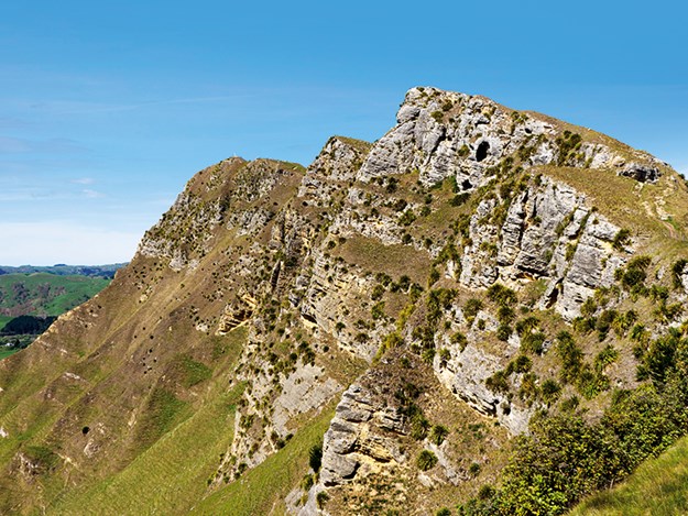
Almost 400 metres high, Te Mata Peak once lay on the sea bed
|
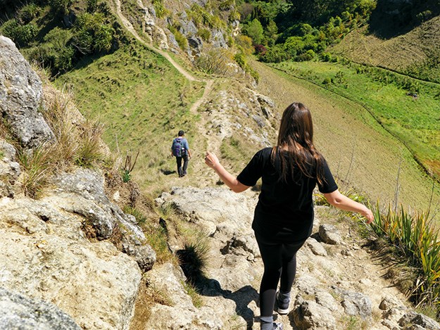
It seems to me that the longer you stay in one place, the less you actually see. Ironic, isn’t it? When you’re constantly on the move, you make the effort to see as much as you possibly can in the time you have. Yet when there’s no rush – well, sometimes you never get around to it. Such was the case during the months we spent in Hawke’s Bay. I saw a Facebook post from a full-time motorhomer friend a while back. The view took my breath away and I immediately made a note to add it to our ‘must-visit’ list when we left Napier. To my utter embarrassment, however, when I looked up the name, I realised it was just down the road from where we were! That place was Te Mata Peak.
Suffice to say, there was no way I was leaving the area until I had seen that view for myself. As it happened Gareth’s mum, Christina – also a full-time nomad – came to visit so, no sooner had she arrived than we dragged her (willingly) for a good, long hike.
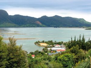
Te Mata Park is part of lands originally owned by John Chambers in the 1800s. In 1927, his sons gifted a 242-acre reserve on the upper Havelock North hills to the community as a memorial to their father. With incredible views across Hawke’s Bay and Heretaunga Plains, it is without a doubt one of the area’s most loved and visited places.
 |
|
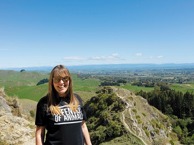
At last I got to experience Te Mata Peak for myself!
|
Something for everyone
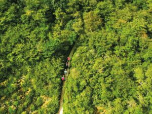
Te Mata Park is a larger than life natural playground for all ages. You can walk, or bike it, take the dog, go orienteering or geocaching – you can even hang glide it. I had just one goal in mind though, and that was to walk to the top, so we opted for the longest of the available walking tracks; the Rongokako (Blue) Trail. A more challenging trail, its description sounded amazing and, from the first step, it didn’t disappoint. Just a short way into our leisurely amble, we passed through a valley of enormous kowhai trees, which were laden with not just bright yellow flowers, but more tuis than we had ever seen in our lives. The air rang with a cheerful cacophony of more beautiful birds than we could count, so close you could have reached out and touched them. What a treat – and we had only just begun!
 |
|
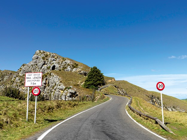
You can drive up the narrow road to the top – if you’re game!
|
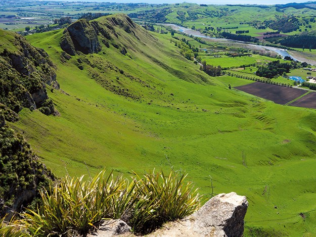
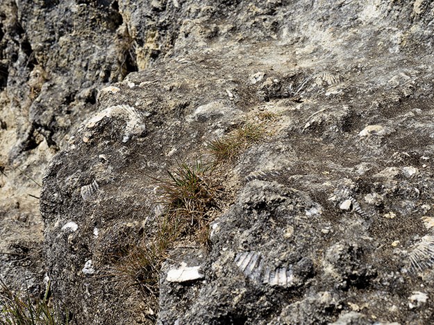
The track up to the summit is well maintained and mercifully not as steep as we had feared. Rising to 399 metres at its summit, the rocky ridges which make up the peak once lay on the sea bed, before being bowed upward by geological forces. The tell-tale sign is in the many cliffs and outcrops, studded with millions of marine shell fossils from as long as 3 million years ago.
“Made it! That wasn’t too bad,” I grinned to the others, as we admired the view from the top, taking in the vast hill country and winding Tukituki River. “Er – this isn’t the top,” said Gareth, pointing over to the next whopping peak on the right. “THAT’S the top!”
So this was why so many people chose to drive up to the summit! We gamely pressed on until at last we reached the real summit – and the incredible 360 degree view was worth every step.
 |
|
The Tukituki River winds through the countryside below
|
Larger than life
The summit is a great place to catch your breath and enjoy a picnic, but being school holidays and already busy, we decided to make our descent. Now we could see why the track we had chosen was marked as challenging… while well-formed and maintained, the steep downhill tracks were loose underfoot in places and we all agreed that it was best done on a fine, dry day as coming down would have been a lot harder if the track was wet and slippery.
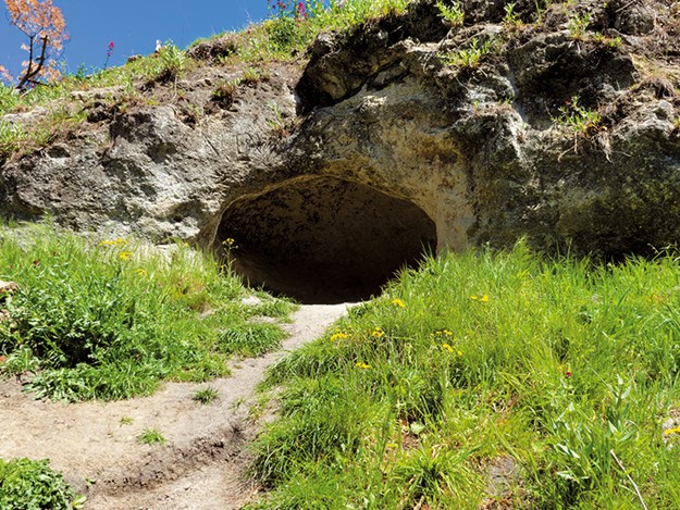
I loved the little limestone caves we passed and couldn’t resist climbing into one and admiring my surroundings.
 |
|
No moas taking a nap in here these days!
|
Little did I know these nooks had once been sleeping and nesting places of the ancient moa who roamed the park. Bones from the mighty birds have been found there as recently as 30 years ago, and apparently there are even remains of droppings in some of the caves. I have to say, I was relieved not to have found any of those…
Everything about Te Mata is huge and majestic and we loved taking a leisurely walk through the forest of over 200 redwood trees, another lasting legacy from the Chambers family. Surmising the Hawke’s Bay climate was similar to that of coastal California, where these forest giants originate, the family planted them in 1927 as an experiment, to see if they would grow. The result is spectacular, with most of the trees now standing over 40 metres tall. The forest floor was the perfect place to stop and finally enjoy our picnic, as the warm sun streamed through the trees. Not surprisingly, the forest is a popular setting for weddings, concerts and even Shakespearean plays.
 |
|
It’s a long way down!
|
As we approached the final stretch of the 5.5km track through Chambers Walk, we were greeted by the unmistakable scent of eucalyptus from the Lemon-Scented Eucalypts Grove. Not only is this area enjoyed by those who walk through it, but also the many birds and insects who feed from it. What a perfect day it was. A more interesting, varied and enchanting walk you will struggle to find, particularly one so accessible to so many.
 |
|
These fossilised shells are 2-3 million years old
|
Just a few days later we left Napier, after almost six months hibernating through lockdown and then winter. It has been such a warm and wonderful home to us. Having first immersed ourselves in the friendly village of Ahuriri, then the bright and quirky art deco of Napier City and now finally ticking Te Mata Peak off my wishlist, I feel as though we have really experienced the very best of unique and unforgettable Hawke’s Bay.
Take a peek at the peak
Take a hike.
Te Mata Park has a network of five well-formed tracks which are enjoyed every day by walkers and joggers. Walk times range from around 40 minutes to over two hours, depending on your level of fitness. Be sure to wear sturdy footwear and carry a water bottle for the longer ones; you’ll most likely need both!
Ancient history.
The Park has a rich human history spanning several centuries. The upper parts of the Park in particular have a strong cultural importance to Maori. There is evidence of past settlement there, including pa sites and other earthworks.
Tribal conflict.
The Waikato Maori are said to have invaded the Te Mata area, and the Ngati Pare tribe, who lived along the range as far as Kohinerakau (Mount Erin), made its last stand at Te Pakake on the western spurs of Te Mata Peak. The women and children who were spared went to the top and held a tangi, looking toward Cape Kidnappers and cutting their faces and bodies with sharp flints before being taken to Waikato.
Get approval for drones.
Approval is required before you can fly drones in the park. For this and more information (or to check whether your motorhome will make it up the steep, narrow road to the Peak!) visit tematapark.co.nz.