 |
|
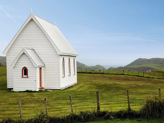
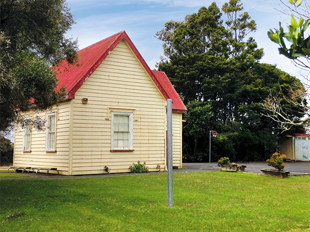
Kohekohe Church
|
Waiuku didn’t appear to be awake as we drove through around 10am on a grey, windy Sunday. We headed northwards on the Awhitu Peninsula; verdant countryside changed from fenced flattish land to rolling hills that grew steeper and creased, plunging down into valleys. Farmhouses and cows were sparse, cars scarce. So too were the views of a silvery Manukau Harbour on our right.
A small brown street sign stating ‘lighthouse’ pointed along Kemp Road, which narrowed and twisted. The Tasman Sea made an appearance, although it was difficult to discern between grey sea and grey sky. At the crest of a rise on Manukau Heads Road we got an unbroken view of the ocean, which left a white line along blackish-brown sand at the tip of Whatipu Beach.
An information board tells of the ship, Orpheus, which hit the shifting Manukau Bar in 1863, and points out the site of the foundering. The sea looked innocent, but it claimed 189 sailors back then and the Orpheus broke up.
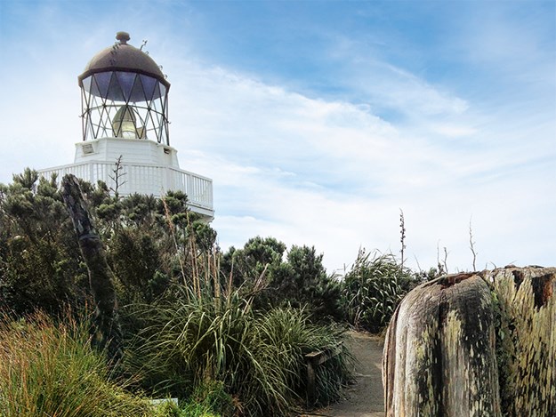
Scenery and history at Manukau Heads Lighthouse
A white dot, bright above a green hill, became the Manukau Heads Lighthouse, a white base topped by glass triangles. Forty kilometres from Waiuku, we arrived at the empty carpark below it. One hundred and twenty steps led upwards. I read on the way that an early Maori description of the place translated to ‘dim and hazy’. Under blackish-grey clouds, the Waitakere Ranges appeared dark and foreboding on the opposite side of Manukau Harbour’s turquoise entrance.
 |
|
Manukau Heads Lighthouse
|
Two years after the sinking of the Orpheus, a signal station was erected here. The semaphore signals, hoisted on a 60-foot mast, must have been tricky to see, let alone read, as ships were navigated across the bar. With winds that apparently reach 200 km/h, it’s a wonder there weren’t more disasters. VHF radio is now used to communicate to ships, manned by a signalman from the signal tower below the platform where I read this information. That must make a captain’s life a whole lot easier.
Standing on the deserted headland, it’s hard to believe that in 1895 several homes and a school with 21 pupils were here. It was also apparently the site of ‘Auckland’s first telegraph and a post office.’
The original lighthouse was situated on a cliff edge to the west and first lit in 1874. It was rebuilt on concrete in 1944, and that was demolished in 1986. The present one was constructed to 1870 plans in 2006 and comprises the original dome and prisms. It certainly looks like something from the 1800s.
From its balcony, I watched a blue and white fishing boat, like a toy in a churning bath of blue water, slowly make its way along the coastline having crossed the bar safely. Views are far-reaching; the settlement of Huia tucked in a bay from where land sweeps out to form fingers with bays between them. Further to the east, so hazy it took me a few minutes to discern what I was looking at, was the Sky Tower, skyscrapers standing at attention either side. To the right, two peaks resemble the shape of Rangitoto. I had never seen Auckland from this direction before; how green it looked.
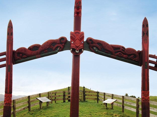
Discovering Manukau Harbour’s Taniwha
Back at the carpark, a distant Maori carving on a rolling hill, its outline like an old sailing ship’s mast, enticed me. In an enclosed, ship’s bow-shaped area, I discovered the carvings depicting the ancestral whakapapa of Ngati Te Ata and Waiohua tribal connections, and that the spiritual ancestor and guardian of the Manukau Harbour is a taniwha called Kaiwhare. Paorae, a stretch of land and once home to a Maori settlement during the 13th and 14th centuries, is now submerged by the sea.
 |
|
Carvings depicting the ancestral whakapapa of Ngati Te Ata and Waiohua tribal connections
|
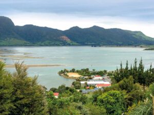
Orua Bay’s Story
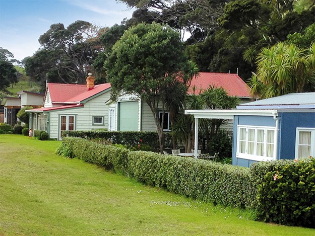
The wind pushed me back down the hill to the car. Around 20 minutes later, heading south-east along Boiler Gully Road and onto Orua Bay Road through isolated farmland, we reached Orua Bay. The road gave only a view of the water and, reaching the beach edge, I was surprised by the sight of a row of houses tucked along the bay back-dropped by trees. Some were basic baches, perhaps the originals built there. A few are modern.
 |
|
Baches at Orua Bay
|
In the playground, back from the beach and camping ground, I learned the first people to live here arrived by the Tainui waka mid-14th century. The first non-Maori resident, missionary William Woon, arrived in 1836 and, in the late 1850s, the first European settlers. Milling kauri and puriri was popular, as was gum digging. Photographs show a bullock team on the beach, a schoolhouse, wharf, and many original homes, most of them now long gone.
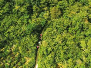
A walk in Awhitu Regional Park
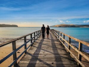
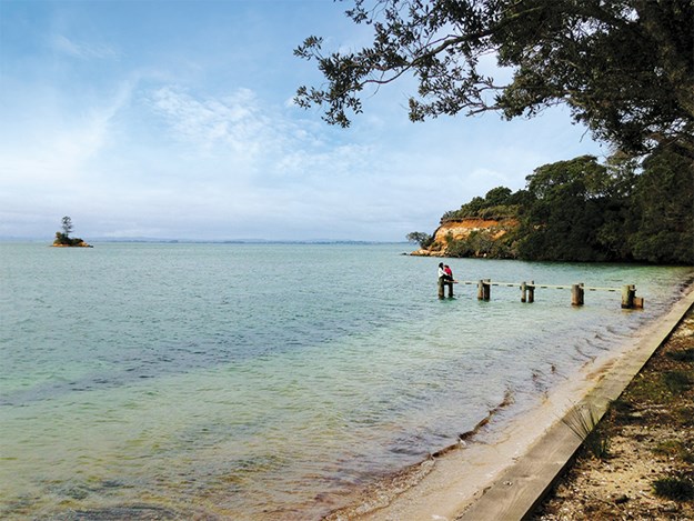
Heading south, we reached Awhitu Regional Park and walked the 3km Settlers Valley Walk, which explores much of it. Crossing boggy ground, we emerged at tranquil Kauritutahi Beach, where a historic jetty juts into the water and a lone tree stands atop Kauritutahi Island, more an overgrown rock than actual island.
 |
|
Kauritutahi Beach
|
A climb brought us to a rusty red-painted wooden bach. Opening its white door, I stepped into the tiny, 18ft sq, three-roomed building. It was dim; dark timber planks form the ceiling and walls. It was built in 1907 by the Brook family, English immigrants. They also built, in 1880, the grander, verandahed Brook Homestead, situated behind the bach.
We peered through sashed windows where signs relate what each room was used for – the pantry, parlour, narrow bedrooms and a bathroom where an old, white metal bathtub takes up most of the space.
The Brook family was almost self-sufficient; they had an orchard, vegetable garden, sheep and cattle. Any supplies were brought once a month by boat, which landed at the jetty down at Kauritutahi Beach.
>We continued on the trail, sometimes in bush, and popped out onto white sandy Brook Beach. A climb took us to farm paddocks where Jersey cows viewed us as we viewed the sea, land dotted with houses breaking the greenery, and plumes of white smoke billowing from Glenbrook Steel Mill in the distance.
 |
|
Pollok School building
|
Southbound, we passed through Pollok. With its steep roof, the weathered, cream school building with sash windows reminded me of a church. Constructed in 1883, it looked abandoned; indeed, the Kohekohe Presbyterian church on the side of Awhitu Road had been. Worshipped in from 1886 to 1976, it was for sale. Between peaks of hills beyond it, the sea looked like the sky’s shadow.
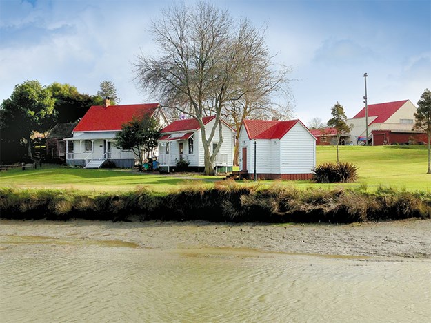
Waiuku’s heritage buildings and trails
Back in Waiuku, I was disappointed to find the museum, housed in the original fire station, was closed. It supposedly opens on Sundays from 1.30-4pm, but not this time. Apparently it has Maori and European artefacts, and collections and displays concerning Waiuku’s history.
 |
|
Historic buildings in Tamakae Reserve
|
Tamakae Reserve, which it backs onto, has heritage buildings built in the late 1800s clustered along the estuary’s waterfront. There’s the Waiuku lock-up (once the jail), Pollok Cottage, Hartmann House (now an art and gift shop), the Anglican Vestry, a rebuilt Creamery – which farmers would bring their milk to for collection – and Maioro School building, built in 1923. Sadly, they too were all closed up.
The Heritage Trail took us along Queen Street to the two-storey, balconied Kentish Hotel, built in 1851. It lays claim to holding New Zealand’s longest continuous liquor licence. Among others it attracted Sir George Grey, Richard Seddon, and Maori King Te Wherowhero, who visited in 1860.
Inside, photographs of the peninsula’s wharves decorate a corner while other images feature Waiuku life, famous New Zealanders and the hotel over the years – one leaving me wondering how the balcony stayed standing with the crowd on it. A support column has rope wound around it and white cloth draped either side across the ceiling, decorated with a map of New Zealand, resembling a ship’s mast and sails.
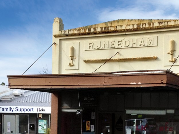
A heritage board shares information on local history, buildings and people on the corner of Queen and Bowen Streets, where Ray White occupies what was once Flexmans, a general store built around 1865. Across the road is the art deco-looking National Bank, built in 1914. Green Mango Thai Restaurant resides in a building that was once the butchery of H Barnaby, and the wooden Wesley Methodist Church has been standing on the same high spot since 1883, previously the site of a defensive blockhouse during the 1863 land wars. LK Café, where the ginger and date slice was delicious, is opposite. On its façade, above a roof extending over the footpath, is the name R J Needham, with sculptures either side looking like pipes with taps on. Maybe Needham was a plumber… The 1872-built Holy Trinity Anglican Church’s bell was still, arched windows closed, door shut.
 |
|
A cafe now occupies the R.J. Needham building
|
From an information board at the carpark overlooking the estuary on King Street, I discover a love story. A young Waikato chieftainess came here to marry a chief from the local tribe. Two brothers were chosen – Tamakou, who didn’t interest the woman; and Tamakae, who was working in kumara fields at the time. Elders washed Tamakae with fresh water (wai) and white soaplike clay (uku) before presenting him to the chieftainess, who fell in love at first sight. he spot where Tamakae was washed became known as Waiuku. Established in 1851, it had been a busy port since 1840. Goods and passengers were ferried from, and to, Onehunga. I read of pig carcasses hanging in the open air on the Pono as they were transported to Aucklanders.
The Waiuku Trails run either side of the estuary, the left side having been recently constructed. We walked the right, from the carpark, passing the blue and white Ratahi, which plied the waters of the Bay of Plenty for 80 years, high and dry in the mud. It takes tours, cruising the Manukau, or up the Waiuku River when the tide is right.
The trail followed the coastline out to a point where the harbour stretched before us. White plumes still rose from the steel mill, the sea shimmered under the setting sun.
We could have gone further around the coast. But it was time to head home to Auckland’s west… although I was tempted to remain in this historic, south Auckland pocket of peacefulness.
For Manukau Harbour or Waiuku River Sailings: manukaucharters.co.nz
Waiuku Museum: waiukumuseum.wordpress.com
Map of Awhitu Regional Park: aucklandcouncil.govt.nz/parkmaps/map-awhitu-regional-park.pdf
For camping:
Awhitu Regional Park: aucklandcouncil.govt.nz/parks-recreation/stay-at-park. Search Peninsula Campground or Brook Campground.