Eleanor Hughes walks and cycles around this Waikato town, once the seat of the Māori King movement.
Ngāruawāhia had never figured on my destinations list – it was somewhere bypassed on the way south. However, with a tramping club cycling trip along the Te Awa River Ride planned and Ngāruawāhia the base, I got the chance to explore and found plenty to keep me occupied over the weekend.
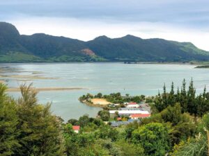
Arriving in town early afternoon, we were soon off exploring The Point. Located in Ngāruawāhia Domain to the west of Great South Road, once busy State Highway 1, The Point lies at the confluence of the Waikato and Waipā rivers. It’s where the first Māori king was crowned in 1858.
Autumn leaves made for picturesque scenes along the quiet riverside where, back in the 19th century when Ngāruawāhia was an important port, we would have seen steamboats and ferries. At The Point’s far end stands a 1912 band rotunda erected by the Regatta Association, regattas being held on the river from the 1890s. Heritage boards, on a 10m waka-shaped display, tell how the town takes its name from the saying ‘Wāhia ngā rua!’ (open the food pits). This was a chief’s call at the celebration of the birth of a child, the feast of food stretching from The Point to Pukeiahua Pā (Havelock Hill).
The Māori legend of the Waikato River’s formation is told along with the Māori and European history. Europeans settled the town in 1864, calling it Queenstown. Later it became Newcastle, and in 1877 it was renamed Ngāruawāhia. A diagram shows where shipping offices, a blacksmith, building yard, hotel and other businesses were on The Point around 1900, when it was the town centre.
A World War I memorial stands not far off and opposite that, a gun turret. This came from the gunboat Pioneer, part of the river fleet used in the 1863-64 British invasion of the Waikato.
Waterworks Walk
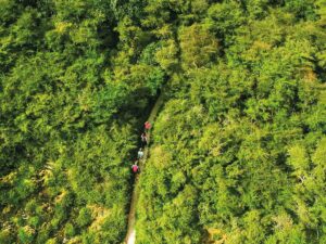
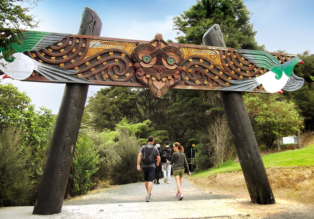
A short walk along Waingaro Road, crossing the Waipā River, and onto Hakarimata Road brought us to the start of the Waterworks Walk and Hakarimata Summit Walk, marked by a Māori carving.
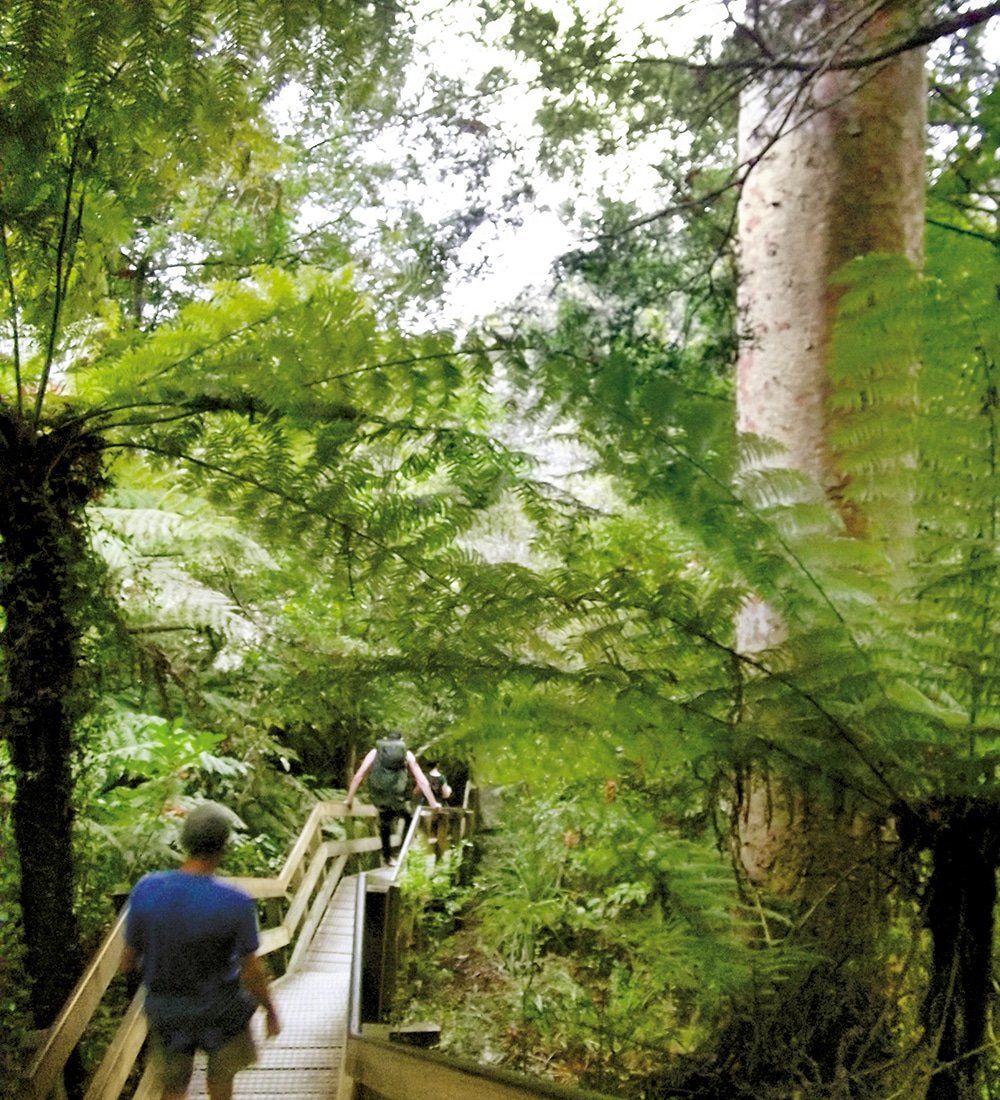
Following a stream, the Waterworks Walk is a pretty, 900m bush trail with a few stairs to climb, taking about 30 minutes one way. It passes a small waterfall and ends at a 1922 reservoir, its concrete wall now covered in green moss, which once supplied the town’s water. Long-finned eels and crayfish live in the reservoir, but we saw none in the brown water.
Hakarimata Summit Track
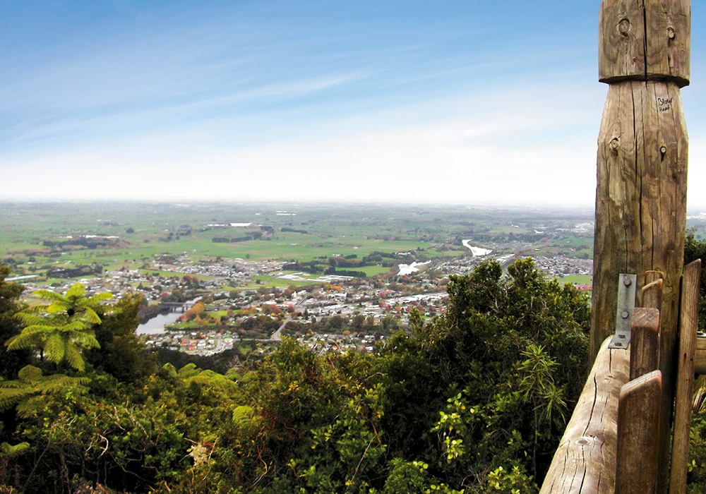
This trail branches off near the top of the Waterworks Walk, and it’s about another hour to the 335m summit. There are lots of stairs – 1349 to be precise! The pleasant walk gives glimpses of the township and surrounding flat, green Waikato land through gaps in the trees. However, the summit tower provides the best view: a silvery Waikato River passing under the rail bridge and weaving its way into the distance; Ngāruawāhia spread out, houses clustering on the river banks; dark, rolling hills looming further north. Had it been a clear day, we could have seen Ruapehu.
Tūrangawaewae House
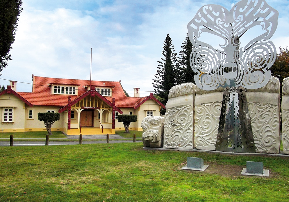
Back in town we came across Tūrangawaewae House, a Category 1 heritage building. Erected in 1919 and designed to house a Māori parliament, its porch and gables are decorated with Māori carvings. Opposite is a striking rock and metal sculpture, ‘The Kings’ Mask’, representing facial tattoos of the first two Māori kings.
Streetscape
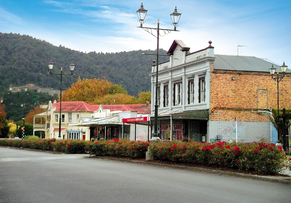
The Waipā Hotel is prominent on the corner of Great South Road and Jesmond Street, a replacement for the one burnt down in 1917. It’s a shame the two-storey building looks so uncared for, appearing long shut for business. Two or three buildings along deserted Jesmond Street, lined with verandahed shops, look as if they might date from the early 1900s, as do the towering, black lantern lights positioned at regular intervals along the rose garden median strip. Around the block on Market Street a few well-kept old villas stand. The Delta Hotel, built in 1900, occupies its corner with Great South Road. The upper storey features sash windows and a verandah, but the remodelled ground floor exterior is characterless.
The RSA, next door to the Delta Hotel, didn’t look particularly inviting, the concrete-pillared entrance reminding me of a mausoleum, but the locals inside were friendly and the evening meals huge and well-priced. The sirloin steak for $15 was excellent value.
Te Awa River Ride
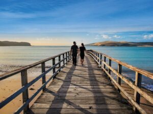
Sunday dawned grey for the 27km ride to Hamilton Gardens. Ngāruawāhia Domain marks the start/finish of the Te Awa River Ride, a cycling/walking trail following the Waikato River to Karapiro. (Hamilton Gardens to Cambridge is still on road, the trail due to be finished by the end of 2021.)
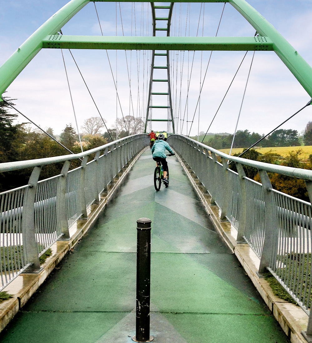
Along the mainly flat cycleway, boards detail the story behind Ngāruawāhia’s name, and tell of flax mills that stood nearby, employing many during the late 19th/early 20th centuries. Crossing Perry Bridge, one of the longest walk/cycle bridges in New Zealand at 130m, I looked down on the still Waikato reflecting riverside vegetation. The bridge design is inspired by the flax-milling history, its numerous crossing cables representing a giant loom with a warp ready to be woven.
I learned that freshwater mussels eat contaminants in the river, long-tailed bats hang out in Hamilton and that when kōwhai trees bloom, it’s time to plant kūmara. The concrete path took us past Fonterra and Te Rapa power station, next to each other, where I read facts and figures on both. The river remained motionless under a grey, showery sky as we rode past farmland, alongside rural roads, admired large homes overlooking the river on Hamilton’s outskirts and passed the Waikato Equestrian Centre. The trail took us briefly along Pukete’s footpaths, then returned to the riverside.
Near central Hamilton, two hours in, we decided to turn back. In wet weather, Hamilton Gardens was not a great destination. Bike tyres sprayed up water, low, wispy clouds hung below a gloomy sky, and scattered rain dampened us more, but the ride through peaceful, lush surroundings was enjoyable and worth doing. As was discovering Ngāruawāhia.
More Information
- Bike hire: riverriders.co.nz
- Te Awa trail: te-awa.org.nz
- Freedom camping at The Point: nzmca.org.nz