Four days, no kids, and I was visiting a good friend in Queenstown. Well, it would be a shame to waste that amount of free time, wouldn’t it? As tramping is a favourite pastime for both of us, we started researching three-day tramps in the region.
I have always been interested in the four-day Greenstone Caples Loop, but with only three days available to us, we decided to look at all options. Walking from The Divide on the Milford Road through to Lake Wakatipu via either the Greenstone or Caples Valley was our solution. We caught the last bus of the season from Queenstown to The Divide, which is about an hour’s drive past Te Anau and is the starting point for the Routeburn Track. Our bus left Queenstown at 10.45am and after four hours of a gorgeous scenic drive, including a brief stop at the Mirror Lakes, we were dropped at The Divide.
Undecided as to whether to tramp to Wakatipu via the Greenstone Valley or across the McKellar Saddle and down the Caples Track, we checked the weather forecast. With cloud and rain forecast for the next day, climbing up and over the saddle was not appealing, so Greenstone Valley it was.
Greenstone Valley Track
Unfazed, we set off. The track was wide and well maintained. It zigzagged gradually upwards through native tree fuchsia and red beech, and soon we reached the turn off up to Key Summit—an alpine plateau. With striking views on offer, it would have been a sin not to make the side trip, so up we went. The beautiful, fragile environment of alpine plants and a picturesque tarn, surrounded by views of the Fiordland mountains, made the climb well worth it.
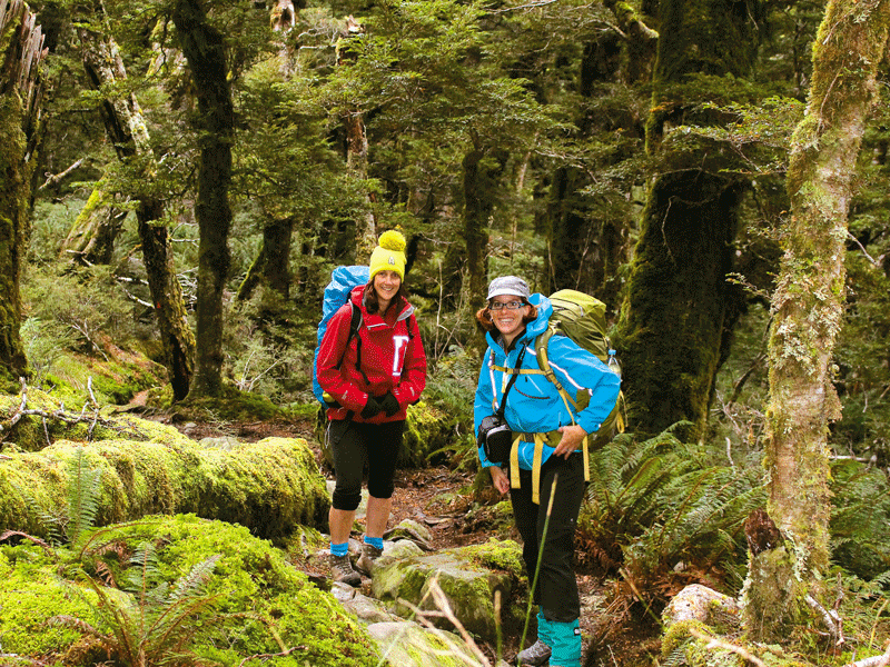
But there was no time to hang about, so it was back to the main track and onto Howden Hut. The track became more of a tramping track from this point, but it was still wide and easy to follow. With tall red beech trees towering above us and gorgeous mossy ground cover, it was quiet and peaceful.
Soon we reached the fork in the track. To the left was the saddle separating the Greenstone and Caples Valleys and ahead of us were views further down the Greenstone Valley—the direction we were heading. We enjoyed the evening colours for a few minutes and then carried on.
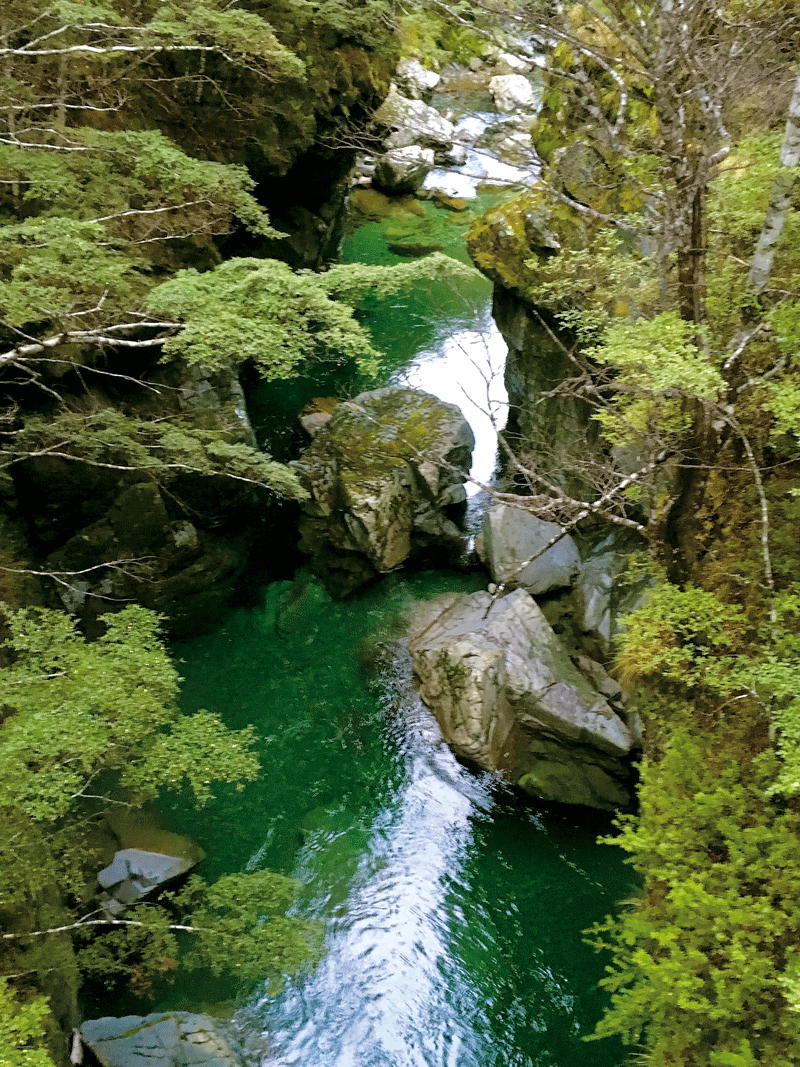
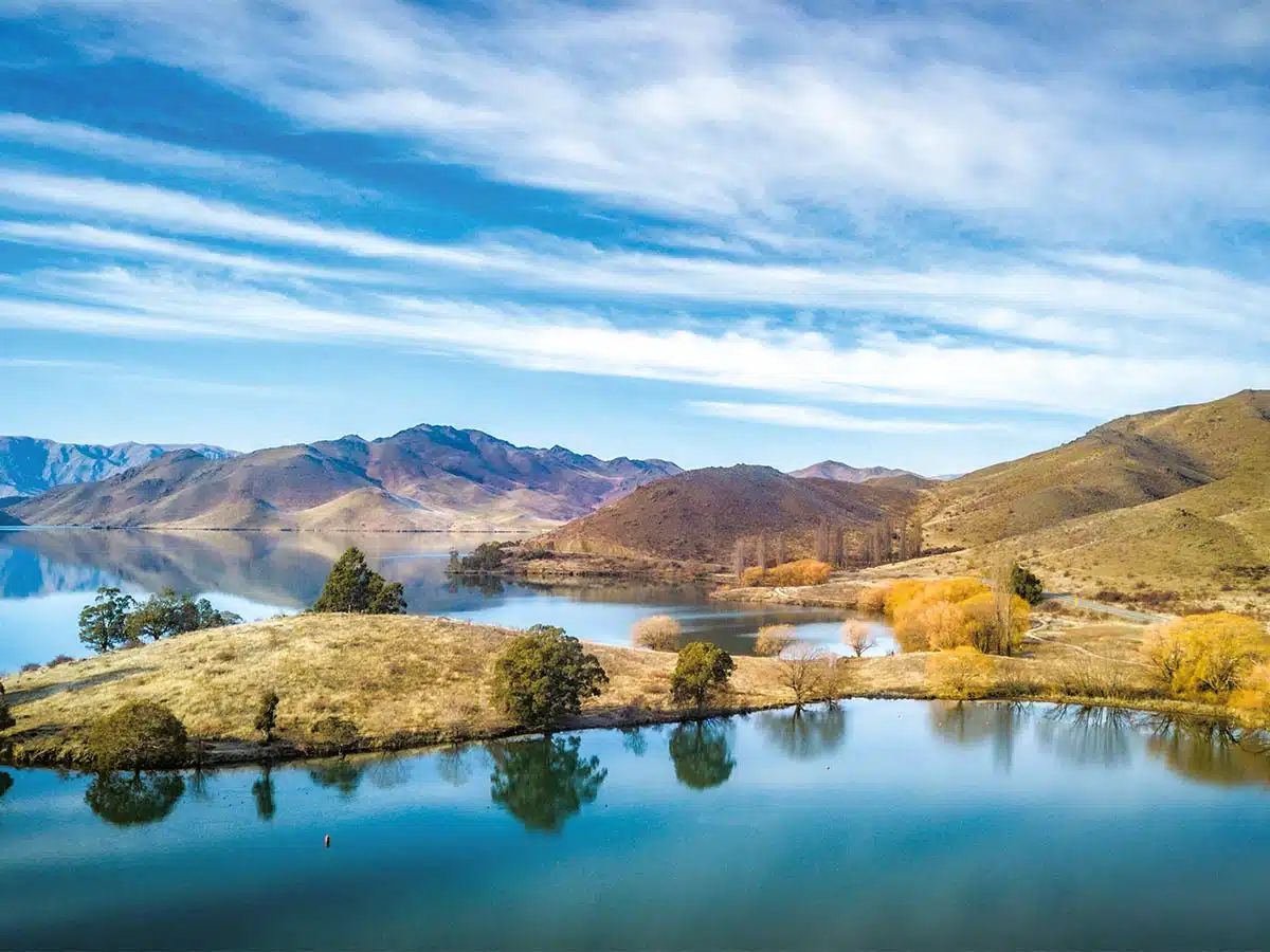
After another clearing with gorgeous views of Lake McKellar and mountains around it, the track travelled around the true right of the lake, once again through the dense forest. Occasional glimpses of the water could be seen, but the track never actually came close to the lake.
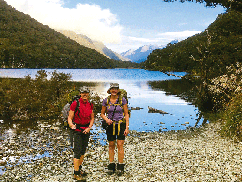
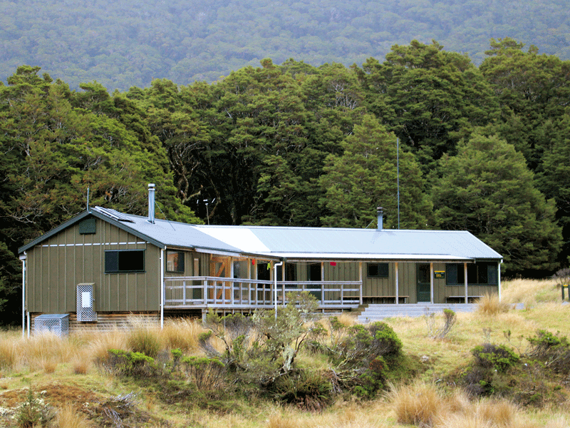
As darkness started to descend, we eventually stopped to pull out our head torches. This made traversing roots and rocks much easier in the fading light. Soon after, we arrived at McKellar Hut—a 24-bunk hut has two bunkrooms separate to the kitchen and dining area. A group of hunters and two other trampers were at the hut already, the fire was lit, and it was cosy.
The Greenstone Valley
The next morning we crossed the adjacent stream and were soon walking through the stunning Goblin forest. Although it wasn’t strenuous, at 18km, it was the longest day.
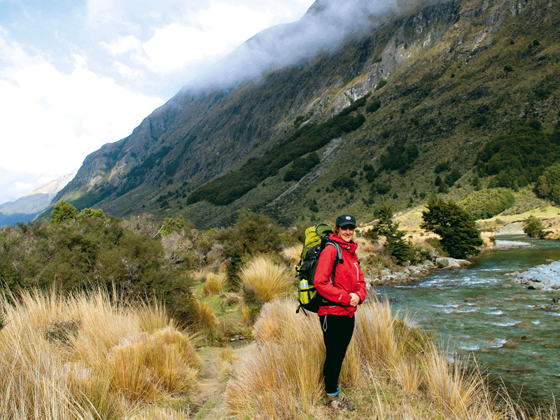
Walking through the beech forest, we wandered along at a leisurely pace. After an hour and a half, we came out onto the wide tussock-covered valley floor through which the Greenstone River meandered. The Greenstone Valley was carved out by an ancient glacier and tall mountains border it on either side.
Arriving in the valley at the same time was a helicopter that had travelled up and down a few times before landing 200 metres from us and depositing two men and half a dozen dogs. We watched the men head down the valley, but soon they reached a large herd of cattle on the far side of the valley and the muster began.
We followed them for a short while until our track took us back into the beech forest, and so began a pattern of walking along the side of the valley in the forest for a time before dropping into the valley to negotiate the muddy, swampy surfaces that made up the track. The roots, rocks, and mud made it a real ‘tramping track’ but it was brilliant despite this, with great views and a rainbow arching across the valley.
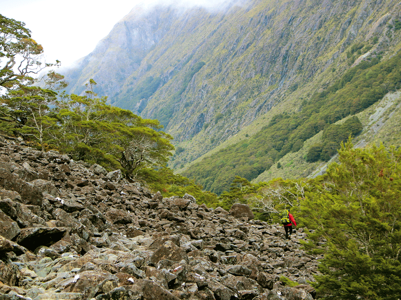
Soon after lunch, the track passed under two huge old landslides. Large boulders and smaller rocks were clambered over, with the odd nervous glance up to mountain side.
There are several huts in the valley that the track passes, including private lodges and huts managed by the New Zealand Deerstalkers Association. Early afternoon, we reached another track intersection at Steele Creek where a rough route can be followed linking the Greenstone Valley to the Caples Valley. It is noted to be pretty rough and strenuous and recommended for experienced trampers.
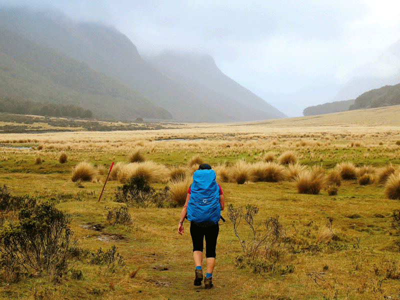
We continued down the wide valley as the rain finally set in. The geology was fascinating with a series of river flats clearly showing the levels the river has been over the millions of years. The track eventually climbed back up the hill into the forest. We were only five minutes from the turn off to Greenstone Hut and were soon out of our wet gear and relaxing in the hut with another band of hunters and a young tramper from Catalonia.
Hurdles along the way
With a pick up organised at the Wakatipu road end, we set off early. As we rounded a bend, we found the track barricaded with a fence of sacking and at least 50 cows and calves herded into the area. We clambered into the forest above the track and tried to sidle around the cattle. But when that didn’t work all we could do was drop down to the track and herd the cattle on in front of us. Soon we were joined by our fellow tramper of the night before. For nearly two hours, we followed the herd through the beech forest and finally managed to get pass the huge beasts when the track dropped down into the river valley with its wide grassy plains.
We followed along the river and came across a haunting dead forest in the river valley. My tramping mate was confused. She had done this stage of the tramp before and did not recognise the area. Sighting an orange arrow, we picked up a track along the edge of the bush line and soon reached an intersection.
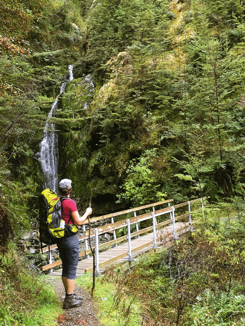
Here we had the option to cross a stockbridge and take a longer loop to the road end, or head up the hill for the more direct loop. Hearing the cattle baying on the far side of the stockbridge, we opted to head up the hill. A fairly long climb found us reaching another intersection, the signpost directing us to either the road end or back along a lovely wide flat track to the Greenstone Hut. This was the track we were supposed to be on! We had missed the turnoff for the main track, as we had been concentrating on herding the cattle. From here, the track sidled along the hillside above the river. The predominantly black beech forest was lovely to walk through although we did negotiate a few slips. Tall thin waterfalls featured in a couple of places along with a swimming hole.
Ngãi Tahu’s gift
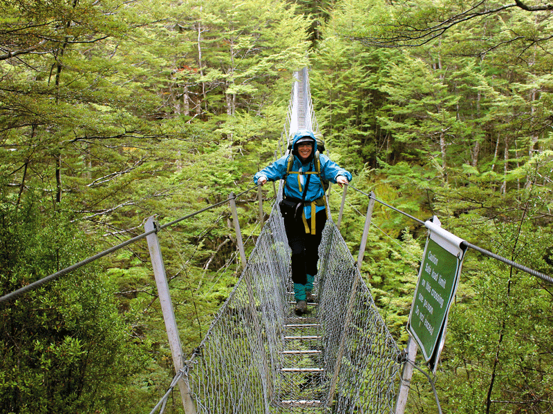
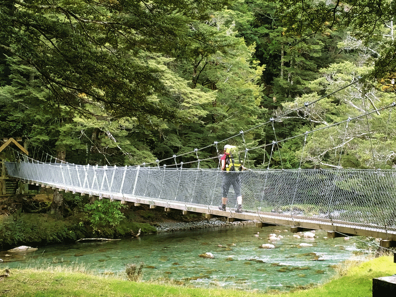
Eventually, after crossing a grassy valley covered in matagouri, we reached a large swing bridge. Here the Caples River and Greenstone River converge and the swing bridge crosses the Caples River.
Near the bridge, a panel tells of Ngãi Tahu’s gift to the people of New Zealand, of much of the area we had just tramped through, the gift being part of the settlement of Ngãi Tahu’s historic land claims. Known now as Kã Whenua Roimata, ‘the land of tears’. The name is apt, the weather we had experienced over the last few days being proof of this.
One last climb through red beech forest and down the other side saw us reach the road end in good time for our pick up
Now, would my tramping mate’s 22-year-old son remember to pick us up? With no mobile phone coverage, it was a nervous wait, but, only 30 minutes late and he was there.
A stop in Glenorchy for a flat white was the perfect way to end an amazing few days.