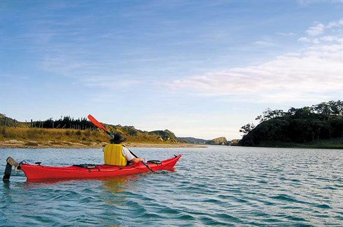
Kayaking up the Taiharuru River estuary in the early morning light was truly magical. The tide was fully in, giving the estuary a lake-like appearance.
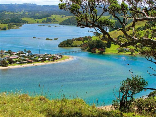
It was so quiet and tranquil; we could have been the only people in the world. Taiharuru, and the neighbouring Pataua and Horahora Rivers, empty into estuaries along the stretch of coastline between Bream Head and the Ngunguru Sandspit, north of Whangarei Harbour.
Roads here are few and comparatively recent, the settlements tiny; the remoteness makes it easy to feel as if it all belongs to you.
Beginning the route
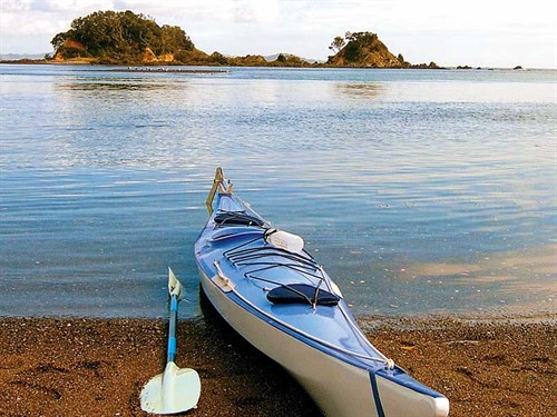
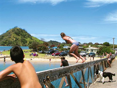
We launched the kayaks in the sheltered, shallow waters of the bay near the Pataua campground where a scatter of little islands stretch from Pataua Island almost to Taiharuru Head. Pataua is a larger settlement than Taiharuru, mainly holiday baches, and boasts a campground.
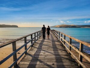
The Pataua’s north and south are joined by a footbridge, popular with kids in summer. It’s a great place for them to fling themselves from, in attempts to cool off and generally have fun. We launched our kayaks and set off to explore as far up the river as we could get.
After paddling through a wide, open stretch of water bordered by low hills, the channel turned south, meandering past mudflats and mangrove-lined banks.
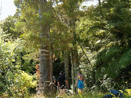
Our route continued to twist and turn and narrow, then we came to a little shingle beach. We stopped here to admire a stand of kauri and enjoy a picnic lunch before continuing up the river. Before long, we came to the place where several smaller streams met, forming the river.
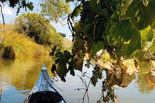
I stopped here, using a grapevine (that had perhaps escaped from cultivation somewhere inland) for shade, while Malcolm ventured further still, up the Waikare Creek. When this waterway became so narrow that turning was almost impossible, he returned and we pointed our kayak’s bows back towards the coast.
Climbing Te Whangai Head
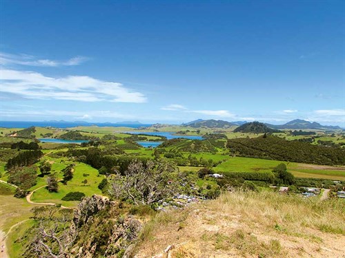
Before leaving Pataua, we climbed to the summit of Te Whangai Head, a steep hill that was once Mahanga Pa. From here, there were wide views out to sea, where the rugged peaks of the Hen and Chickens Islands were echoed in shape of Whangarei Heads, Mount Manaia, and Kauri Mountain.
Inland, between the hills, serpentine twists of blue revealed the waters of the Taiharuru and Pataua estuaries. The settlement of Pataua and its footbridge looked like a toy town.
The Horahora River
The Horahora River, a little further north, is not accessed from the Whangarei Harbour but from the Pataua North Road, off Whareora Road in Whangarei. We launched our kayaks at one of the little parking areas where the river brushes against the road.
The river was quite narrow here but soon broadened, and we paddled down around its quiet reaches. It’s strange to think there were once kauri forests just inland from these estuaries. An early map, drawn in the 1870s, marks the hinterland as heavily forested. The land that borders all three of these rivers is now farmland. We rounded the last bend before reaching the coast at the river-mouth.
It was a calm day, so we pulled our kayaks onto the beach and hopped out. We wandered along the deserted sandy beach towards Goat Island, where a solitary yacht was anchored. In by-gone days, early travellers used the beaches as highways. The missionaries Colenso and Williams recorded their travels through this area.
Before this, the area had been populated by Maori. In 1875, moa bones were discovered in the mouths and estuaries of the three rivers. Prior to this, it had been thought there had been no moa in Northland. Further excavations revealed extensive shell middens and, as well as moa bones, those of fish, birds, seals, and humans. Some of these had been exposed by erosion.
Our beachcombing resulted in nothing more interesting than shells and driftwood. It was hard to imagine that the quiet river mouth and lonely beach had once been home to families of Maori and the giant birds they hunted. As we paddled back to our landing spot, we reflected on the history of these now quiet rivers while enjoying the unique beauty around us.
We think kayaks are the best way to explore and enjoy rivers such as the Horahora, Taiharuru, and Pataua.
Further information
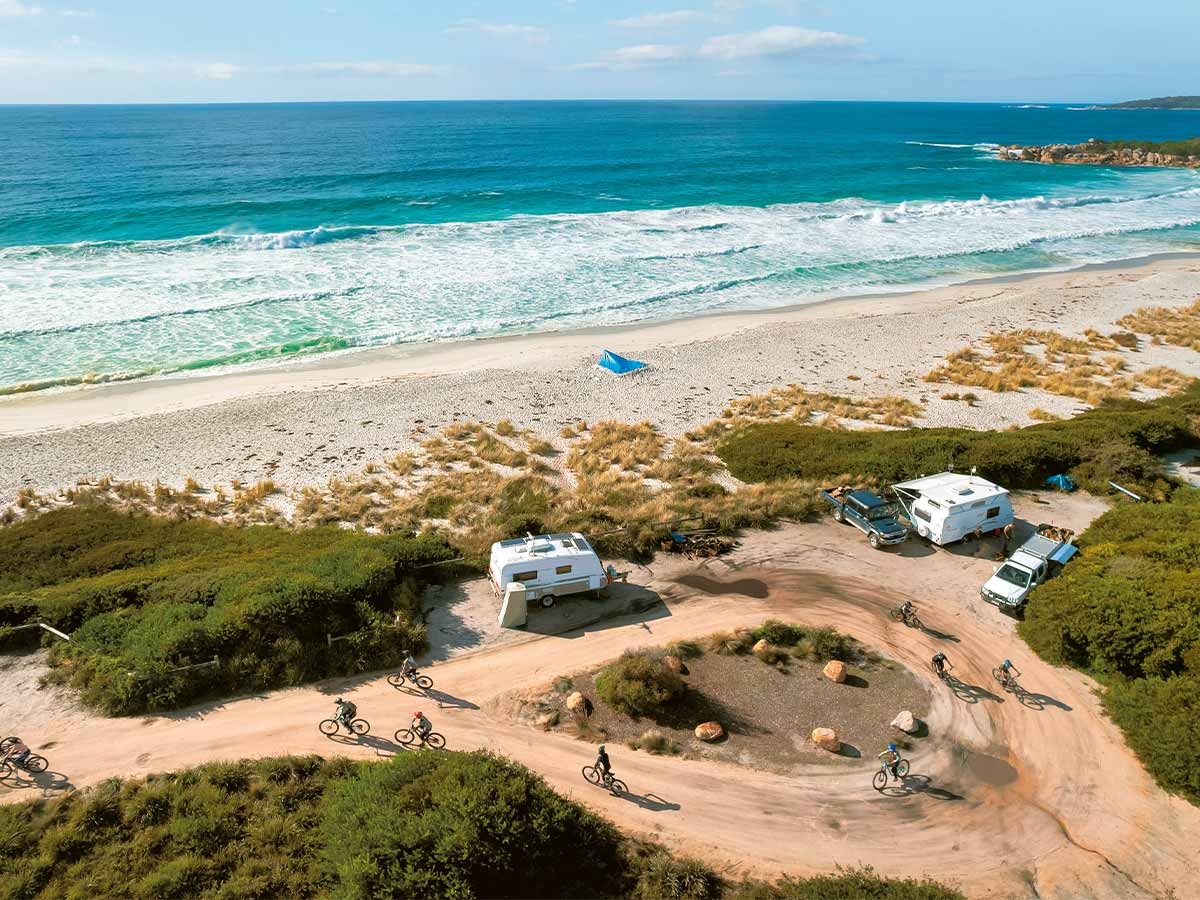
- There are 80 powered sites and 40 camping sites at the campground at Pataua South.
- There are several campgrounds in Whangarei—a Motorhome Friendly Town.
- Information about freedom camping can be found on the Whangarei District Council’s website